AerialPhoto-SealeSwap.jpg
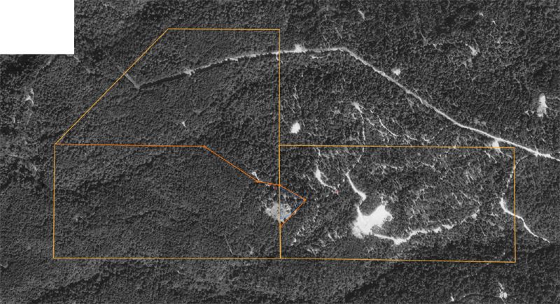
Boundary line adjustment map showing Rick's 80 acres (rectangle on right) and Riley's 139 acres (remaining outline on left); Rick exchanges small triangle for Riley's top half as indicated by darker orange lines; note: aerial photo clearly shows recent logging activity on Rick's land constrasted with the forest on Riley's land that has not been cut in 30 years